Le Bois de Saint-Sauveur
To relax for a moment during the day and take a deep breath of fresh air, take this walk, accessible to equestrians and mountain bikers, in the Saint-Sauveur woods, before a short detour to the banks of the Lez spring.

In the garrigue...
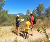
The Bois Saint-Sauveur is a forest of pines and garrigue with views over the hills. The hike leads to the source of the river Lez: a refreshingly calm, bucolic spot.
Family-friendly and accessible to all, this hike is a delight for young and old alike, thanks to its gentle gradient. It's the perfect way for the whole family to get together and enjoy each other's company.
Starting point: Saint-Clément-de-Rivière
At the far end of the parking lot of the Office de Tourisme du Grand Pic Saint-Loup, take the asphalt path. Leave it to reach the green barrier at the entrance to the wood.
Climb up the main gravel driveway, ignoring the trailheads to the left and right. Pass a crossroads of D.F.C.I (Défense Forestière Contre l'Incendie) tracks and continue for 100 m.
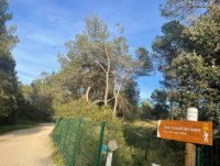
Pines, arbutus and laurel mattes...
At the bend, take the left-hand path down into the pine forest. Cross a dry stream, then a second one. Continue along the track for 30 m and climb uphill between pines, oaks, kermes, boxwood and caddis trees.
Cross three tracks, then descend on the path that continues under pines, arbutus and tinsel laurel mattes. Leave the undergrowth, cross an open area and reach a track. Turn right and join the D112 (barrier).
Along the Lez...
Cross the road, then turn left onto the path that runs alongside the Lez and leads to the relaxation area at the source of the Lez. Reach the entrance gate to the parking lot. Turn left onto the D112 for 50 m, cross the road and climb a steep slope.

Instant Picnic.
Cut the track, climb up and reach a rest area (tables). Turn right along the path to reach a semi-circular D.F.C.I. cistern. Continue straight ahead along the stony path. It leads to a galloping track used by the former UCPA equestrian center.
Around naturalism.
On the way back.
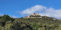
Turn right onto the path alongside the sandy galloping track and make a loop (180° view of the Château de Restinclières, the avenue of plane trees at the source of the Lez, the Hortus cliffs and Pic Saint-Loup). Continue along the edge of the galloping track for 150 m, then turn right onto the stony path. It climbs up to a small promontory.
Continue to the lycée, then turn left onto the upper track, skirting the fence until you reach the round, glazed building. Leave the track and take the path on the left below (picnic area). Stay on the main path (follow the signs) back to the parking lot.

Type : Pedestrian
Start: Saint-Clément-de-Rivière
Length: 5 km
Duration: 2 hours
Difference in altitude: +122m

To find out more


