Œnorando® between Grés de Montpellier and Pic Saint-Loup
Œnorando® between Montpellier sandstone and Pic Saint-Loup
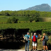
Starting from the winery, hikers will discover a trail through garrigues, pine forests and vineyards, crossing the wild and majestic landscapes of the Pic Saint-Loup. This medium-level loop covers 15 kilometers and takes around 4 hours to complete. A variant is possible for 10 km and around 3 hours.
The topo guide is available from the Grand Pic Saint-Loup Tourisme store.

With spring-like weather forecast in the middle of October, we can't pass up the opportunity to get some fresh air with the family this weekend! As it's still too early to go mushroom-picking in the Cévennes, we're in the mood for an original outing that will give both the children and ourselves a fun and rewarding time: a tractor ride at Domaine de l'Oulivie is just what we're looking for!
Starting point: Assas (cave coopérative)
From the parking lot behind the Cave Coopérative, cross Rue de la Fontaine Haute and turn left. Climb the narrow road through a wood of holm oaks. Follow the GR® 60 for several kilometers. Go straight on until you reach a track (with views of the Hortus cliff and the Pic Saint-Loup). Take the D109E3 for 400 m.
Continue along the track opposite, passing under the Lien (D68). After the tunnel, fork immediately to the left and continue for 200 m.
Short variant (10 km / 3 h): go straight ahead on the track for 600 m and rejoin the main route, in the Rang plain.
Path on the right
Leave the track and the GR 60 to follow a path through the woods to the right. Pass the cellar effluent discharge station in the vineyard's settling and irrigation basin. Walk along a field of vines (through gates), then straight ahead into the woods. Cross a track and go straight across a cleared area. Follow a well-marked path to the left.


Right on the track
Turn right onto the track. Walk 150 m and take a path to the left. At an old dry-stone hutch, turn right and descend through a holm-oak wood. At the crossroads, turn left onto a dirt track through the pines. At the gate, take the left-hand path. Further on, pass under the high-voltage power line.
Panoramic view of the Pic and Hortus
At the crossroads, turn left onto the track (view of the Hortus, Pic Saint-Loup and vineyards). At the next crossroads, continue straight ahead for 600 m. Turn left off the track onto a path through holm oak woods (view of the Languedoc-Granulat quarry).
Pass under the high-voltage power line, descend to the right and then immediately to the left, climbing a narrow path. At mid-slope, turn left and continue up a scree slope. Reach the top of the hill. Descend the slope to a crossroads on the Rang plain.

Plaine du Rang
Go straight ahead, over a bridge spanning the Lien. Just after, turn left and follow the path down to Rieu Coullon. Go straight up and take the track on the left. Walk 50 m, continue left on a path. Go right up to a track, turn left and then straight on.
Saint-Vincent-de-Barbeyrargues
On entering Saint-Vincent-de-Barbeyrargues, turn right onto chemin des Crouzettes, then chemin du Poulaillou. At the crossroads (calvary), turn left onto the D109E2 towards Assas. At the end-of-village sign, take the cycle path and turn right onto Chemin des Ortes.
At the crossroads, turn left towards Assas (view of the château). Turn right after the cemetery. Pass the château and the Romanesque church. Go down rue de la Calade, turn left on rue des Remparts, then right and left again on rue Saint-Denis. Turn left into chemin du Lavoir to reach the parking lot.

Type : Pedestrian
Start: Assas
Length: 15 km
Duration: 4 hours
Ascent +: 160 m
Difference in altitude - : 82m


