Village forts
In the 15th century, the 100 Years' War created a climate of lasting insecurity. In response to the concerns of the inhabitants, the villages were fortified. A new community identity took shape, grouped around the Château de Montferrand.
In the diocese of Maguelone, at the beginning of the 13th century, the majority of fiefs and seigneuries (such as Montpellier, Ganges and Brissac for the most important) were under the episcopal and/or count suzerainty of Melgueil-Montferrand. The county was divided into two administrative centres, with the Château de Melgueil (now Mauguio) to the south and the Château de Montferrand to the north (close to the geographical area of the current inter-municipality).
Situated between an attractive coastline and the Cévennes mountains, the Grand Pic Saint-Loup is an agricultural area, at the crossroads of the trade routes between the Montpellier coast and the inland areas. Its rather scattered population is organised around the manses*, castra* and churches of the various parishes.
The formation of villages as such came late. During the 100 Years' War, when the fighting wasn't raging, bands of idle mercenaries roamed the region, looking to commit acts of violence and pillage. This long-lasting insecurity led the inhabitants to demand the construction of fortified enclosures to protect themselves, which the royal authorities accepted. Gradually, the grouping of inhabitants in and around these enclosures contributed to the development and autonomy of these village forts, which still structure the area today.
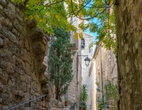
All around the Château de Montferrand, rediscover this medieval past, identifiable in the narrow streets, architectural details, churches and fortifications.
(*): manses: ancestors of farmhouses / castra: plural of castrum: a walled and fortified aristocratic and peasant settlement in the Middle Ages.
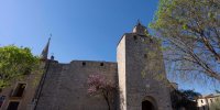
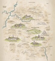
Viols-le-Fort has preserved its imposing 15th-century gate tower, which was recently listed as a Historic Monument. Its 12th-century church was enlarged in the 19th century to accommodate the growing population. Take a stroll down its narrow streets and discover its craftsmen's stalls. If you're a keen walker, the "sentier des drailles" is a lovely trail through ancient transhumance land, leading to the dolmen of the same name.
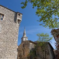
The village began to take shape in the 12th century around a priory belonging to the Abbey of Gellone (Saint-Guilhem-le-Désert). Built by the monks within its fortified enclosure, the church is a treasure trove of the region's Romanesque architecture. The village streets are a haven of peace where you can combine a stroll with historical discovery.
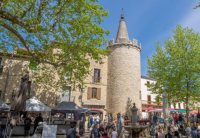
The hamlet was fortified in the 15th century. The castle communicates with the Romanesque double-aisled church via an interior passageway. It was remodelled in the 16th century around its square medieval keep, which still dominates the central square. A charming village at the crossroads of picturesque roads, for a soothing break.
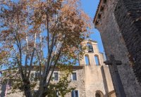
The present-day church and its cloistered enclosure bear witness to the former priory of Cuculles, which depended on Maguelone cathedral. The lower part of the church dates back to the 12th century, and was raised in the 14th century to defend it and provide shelter for the population. Today, it's a superb spot, surrounded by vineyards, and the starting point for a lovely road that will take you to Cazevielle at the foot of the Pic Saint-Loup.
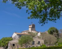
The village was once the seat of the Val de Montferrand community. Today, its narrow streets, so characteristic of its medieval history, are an enchantment.
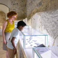
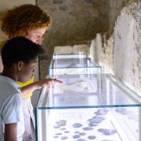
Don't miss the Maison des Consuls, home to the Musée d'Arts et d'Archéologie, a lively dialogue between archaeology and contemporary art, a testament to man's skills and ability to transform his environment.
